More about HKUST

Exploration Lab

(Sep – Dec 2023)

This zone presents six topics that invite you to explore maps with a scholar's mind. The families of European maps demonstrate how map research helps us understand mapmaking history, while the Menzies theory of the discovery of the Americas is an interesting case to test your ability to research and come to conclusions with the help of maps. The traveler stories lead you to reflect on the roles of maps and travelers in the history of cultural and knowledge exchange. You can also see maps that are open for speculation and further research. Lastly, you can find a late Qing map packed with cultural, historical, and geographical references, which lures you to dive in for lots of fun, be it fact or fiction.

Follow the exploration cards in each section to interact with the exhibits in ways that your curiosity leads you!
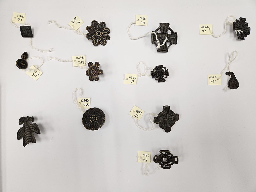
Nestorian Crosses

Nestorian Crosses

c.1272–1368 (Yuan dynasty)
Bronze
Courtesy of University Museum and Art Gallery, HKU
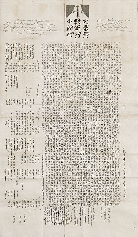
Nestorian Stele in Xi'an

Nestorian Stele in Xi'an

Reproduction from China illustrata, 1667
HKUST Library DS708 .K585 1667
<i>Gujin Diyu Quantu</i><br>[Complete Ancient and Modern Map]

Gujin Diyu Quantu
[Complete Ancient and Modern Map]

China, 1895 (Qing Dynasty)


This was produced in 1895 as a commercial folk piece in the style of New Year woodcut prints. Despite its recency, it follows a cartographic model of China that had been in circulation for two centuries. What makes it unique, and interesting, is the rich text that annotates different places in China and beyond; they tell folklores and stories of historical figures.

<i>Chinae, olim sinarum regionis, nova descriptio</i><br>[China, formerly Region of China, A New Description]

Chinae, olim sinarum regionis, nova descriptio
[China, formerly Region of China, A New Description]

Antwerp, 1592
Abraham ORTELIUS (1527-1598)
38 x 48 cm
HKUST Library G7820 1592 .O78


This is the first printed map of China, with much information directly dervied from Chinese sources. The mapmaker, Abraham Ortelius (1527-1598), made the first printed atlas of the world, and in the 1584 edition he published this map of China. His map was soon reprinted in many cheaper, smaller size editions across Europe. It is easily recognizable for its unusual orientation, with West at the top.

<i>Imperii Sinarum nova descriptio</i><br>[A new description of the empire of China]

Imperii Sinarum nova descriptio
[A new description of the empire of China]

Amsterdam, 1655
Joan BLAEU (1596-1673), Martino MARTINI (1614-1661)
46 x 60 cm
HKUST Library G2306.S1 M3 1655


The map was published by Dutch cartographer Willem Blaeu and Jesuit missionary Martino Martini in the 17th century. It was one of the most significant maps of China at the time, featuring detailed depictions of the country's provinces, cities, and landmarks. Martini created a set of Chinese maps based on his extensive research, travels and observations in China, including maps of each province, and this map of whole country. It was highly influential in Europe, used by scholars and merchants for decades.

<i>Carte la plus generale et qui comprend La Chine, la Tartarie Chinoise et le Thibet</i><br>[The most general map and which includes China, the Tartary Chinese, and Tibet]

Carte la plus generale et qui comprend La Chine, la Tartarie Chinoise et le Thibet
[The most general map and which includes China, the Tartary Chinese, and Tibet]

The Hague, 1737
Jean Baptiste Bourguignon d'ANVILLE (1697-1782)
HKUST Library DS708 .D85 1737


This map covers China as well as Central Asia, which Europeans referred to as Chinese Tartary. It was made by the French geographer d’Anville to accompany a massive four volumes Jesuit work on China. The decorative cartouche includes a rich mix of elements: Tartar warriors with their sheep flocks and tents; two Jesuit missionaries; the emperor on his throne beneath royal flags, surrounded by baroque and Chinoiserie motifs.