Imagined Worlds
Maps do not always depict objective geographic reality or merely serve as navigational tools from one location to another. Maps can be gateways to imagined views of the world, opening the viewer's mind to boundless imagination.
This zone highlights maps of imagined lands, with two focusing on religious views and others attempting to express social and political ideals, sarcasm, and humor. They illustrate the unexpected potential of maps to use space as a means of visualizing ideas and dreams.
![<i>Secunda etas mundi</i><br>[The second age of the world]](../img/5.01.jpg)
Secunda etas mundi
[The second age of the world]
Nuremberg, 1493
This world map, published over 500 years ago, came from Schedel's book "Nuremberg Chronicle." It provides a remarkable record of late medieval cartography, merging the concepts of Claudius Ptolemy with the Biblical tradition. The map displays the world divided between the three sons of Noah: Shem (Asia), Japheth (Europe), and Ham (Africa). The intricate border vignettes showcase mythical creatures from fables, often having half-human and half-animal forms, believed to exist beyond the boundaries of Christendom.

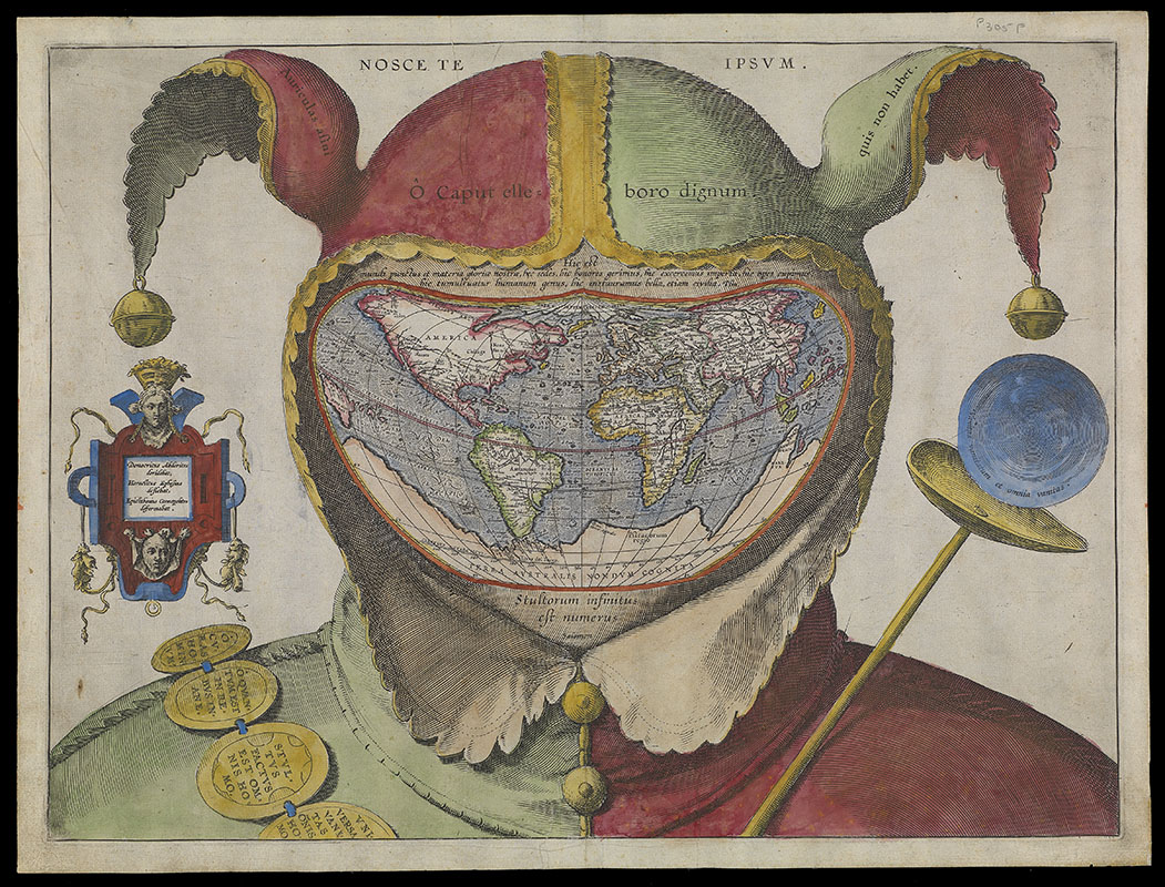
Fool's Head World Map
Publication place unknown, c.1580
42 x 59 cm
Reproduction (Reproduced with permission of the National Maritime Museum, Greenwich, London)
Reproduction (Reproduced with permission of the National Maritime Museum, Greenwich, London)
The Fool's Head World Map is a satirical map based on Ortelius's “Typus Orbis Terrarum.” It features the world in place of a jester's face, with Latin inscriptions referencing the folly and vanity of human pursuits. The badges on the decorative belt crossing the figure's shoulder on the left further emphasize this theme. The map was likely created after 1587 by an unknown maker.