Knowledge Circulation
In the 16th century, commerce and missionary activities drove global cultural and knowledge exchange. Contrary to popular belief that knowledge flowed unilaterally from Europe to Asia, knowledge actually circulated in multiple directions. Many maps from that time propelled the circulation of geographic knowledge. Bustling maritime trade bolstered the importance of navigational sea charts and motivated Chinese and European mapmakers to borrow from one another.
This zone focuses on a particularly special map, the map created by the Jesuit missionary Michele Ruggieri (1543-1607). By comparing important maps from that era, you can explore how multiple sources shaped this map during the late Ming period.
![<i>Sinarum Regni alioru[m]q[ue] regnoru[m] et insularu[m] illi adiacentium descriptio</i><br>[Description of the Kingdoms of China and other kingdoms, and the islands adjacent to them]](../img/3.01.jpg)
Sinarum Regni alioru[m]q[ue] regnoru[m] et insularu[m] illi adiacentium descriptio
[Description of the Kingdoms of China and other kingdoms, and the islands adjacent to them]
Publication place unknown, c. 1590 (Ming Dynasty)
Possibly after Matteo RICCI (1552-1610) and Michele RUGGIERI (1543-1607)
47 x 35 cm
HKUST Library G7400 1590 .S54
47 x 35 cm
HKUST Library G7400 1590 .S54
One of the most valuable maps in our collection is the Ruggeri map. The only other extant copy is in the Jesuit Archives in Rome. It was printed without any indications of mapmaker, publisher, or place of issue. The map was attached to an intelligence report written by Michele Ruggieri, an early Jesuit missionary, around 1588. Apart from the geography, it describes the administration regions of Ming in a table. It also marks the first Jesuit mission and church established at Zhaoqing in Guangdong by Ricci and Ruggieri, annotated in Latin "ecclesia patrum societatis" (Church of the Jesuit Fathers).

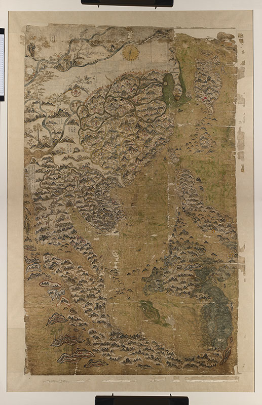
The Selden Map of China
China, c. 1620–1629 (Ming Dynasty)
160 x 100 cm
Reproduction (Reproduced with permission of the Bodleian Libraries, University of Oxford, UK (MS.Selden supra 105))
Reproduction (Reproduced with permission of the Bodleian Libraries, University of Oxford, UK (MS.Selden supra 105))
The Selden Map is one of the earliest Chinese maps to reach Europe; it was acquired by John Selden, a London lawyer, in the 17th century. Its significance was not explored until 2008, when American scholar Robert Batchelor rediscovered the map in Bodleian Libraries in Oxford. The map covers the broad area of China, East Asia and Southeast Asia; it also features shipping routes radiating from Quanzhou, Fujian, making it the earliest example of Chinese merchant cartography, and indicating the extent of China's interaction with the world. Although its exact origins are unknown, recent scholarship suggests that it was probably produced in the early 17th century by a Chinese mapmaker based in Southeast Asia.