


Special Collections at HKUST Library
During the early years of the University, extra funds were made available to the Library from time to time, providing an opportunity to develop special collections. We eventually selected Antique Maps of China and the History of Science and Technology as the two focus areas for our special collections. This is because they were, and still are, unique in this region and, therefore, fill a gap in scholarship.
The History of Science and Technology collection, with emphases on scientific discoveries and inventions in Europe during the past five hundred years, consists of about 530 volumes of rare books and over 1200 volumes of reference titles. Although this collection is modest in size, it offers an illuminating glimpse of the awesome achievements of the human intellect.
The Antique Maps of China collection includes more than 230 maps, charts, pictures, books and atlases. It represents almost all samples of China maps produced by European cartographers from the 16th to 19th centuries. This cartographic archive vividly records the long history of cross-cultural exchanges between China and the West.
These two collections have been stored on compact shelvings with the University Archives until May 2002 when a permanent home befitting the intrinsic value and beauty of these items was completed. The new Special Collections Room furnished with Ming-style bookcases and cabinets will provide appropriate physical and environmental security for these works. Scholars will also have adequate space to view and use the collections. To celebrate the opening of the Special Collections Room, the Library mounted an exhibition on “China in Maps” and organized a Colloquium on “Celebrating Special Collections – Scholarship and Beauty”.
A copy of China Regnum (1593) and a set of postcards made from pictures in our Antique Maps of China collection, have been issued as mementos of this occasion.
Min-min Chang
University Librarian &
Curator of Special Collections
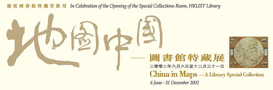
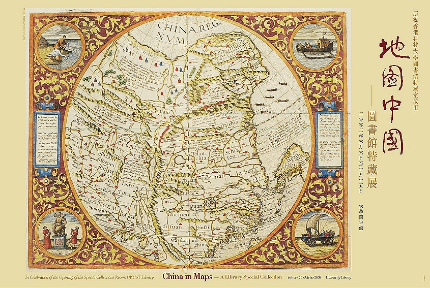
China in Maps: 16th – 19th Century
This exhibition features HKUST Library’s special collection of antique maps. They date from the 16th century through the 19th century and show the growth of knowledge about the geography of China and the surrounding region. The artistic quality of the maps is outstanding, as is their historical value.
The important works of notable mapmakers are represented. The first Western atlas of China by Ortelius, published in Antwerp in 1584, was based upon the surveys of the famous Portuguese cartographer Luis de Barbuda. A decade later one of the most important charts of this region was published in Amsterdam by Linschoten, who collated the reports of Portuguese mariners, thus providing one of the first printed records of Portuguese knowledge of the coasts of China and Japan.
Matteo Ricci, one of the most influential figures in the European cartography of China, arrived in Macao in 1582. His finest work was the multi-sheet wall map of the world produced in Peking in 1602. Ricci placed the prime meridian for the map along the Pacific coasts of Asia so that China remained centrally located as the Middle Kingdom. In 1655, Dutch cartographer Johannes Blaeu published Atlas Sinensis, an important atlas on China by an Italian Jesuit, Martino Martini. The continuing influence of Jesuit cartography can be seen in the works of the late 17th century Italian, Coronelli.
The successor to Martini’s atlas came nearly a hundred years later when new surveys were undertaken by the Jesuits in 1718 for the Chinese Emperor. These formed the basis for D’Anville’s Nouvel Atlas de la Chine, published in 1737. D’Anville’s maps included detailed surveys of the extremities of the Chinese Empire, including one of the first separate maps of Korea and the earliest printed Western maps of Tibet and Bhutan.
The development of the English East India Company’s tea trade with Canton through the Portuguese colony of Macao from the late 17th century contributed to the accurate mapping of the Pearl River Delta. The establishment of Hong Kong in 1841 and the series of conflicts between European powers and China from the late 1830’s to the early 1860’s led to the development of detailed charts and maps of focal points along the Pearl River Estuary and the environs of Canton in particular. Moreover the new treaty ports established along the China coasts at Xiamen, Fuzhou, Ningpo and Shanghai in 1843-44 created interest in new charts of all the China coasts.
Through this historical and cartographic archive, we hope that students, present and future, will appreciate the long history of cross-cultural exchanges between China and the West represented in such vivid visual records.
HKUST Library Exhibition Postcard Series, No. 5
In Celebration of the Opening of the Special Collections Room, HKUST Library
Hong Kong Etc. as Seen from the Anchorage, 1846
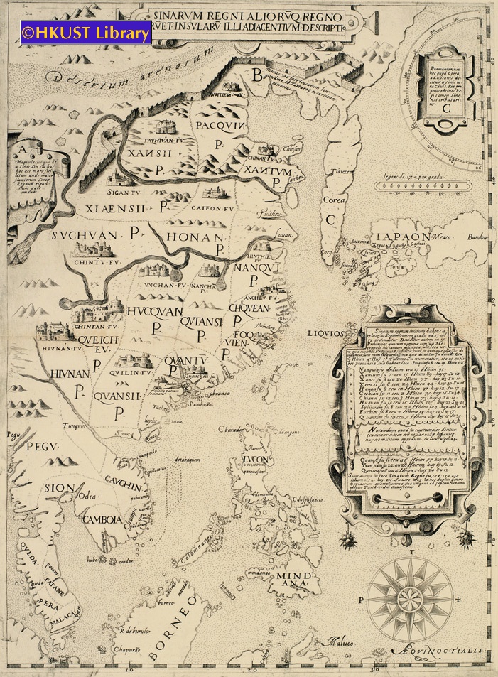
An extremely rare engraved map, centered on China, but showing the Malay Peninsula, Northern Borneo, the Philippines, the Korean Peninsula, and Japan. Interesting features include the Great Wall, an accurate depiction of the course of the Yellow River, delineations of the 15 Provinces, and an inserted table showing different administrative and regional divisions in each Province. Anonymous (possibly after Matteo Ricci & Michele Ruggieri).
An engraved map of the Bay of Amoy (廈門) in Fujien Province. It is one of the earliest detailed Western charts to depict the coast of China.
By Isaac Commelin from his Begin ende voortgangh van de Vereenighde Nederlantsche Geoctroyeerde Oost-Indische Compagnie. Accompanies Zeyger van Rechteren’s description of his voyage to East Asia and Southeast Asia in 1629 as a Dutch East India Company doctor.
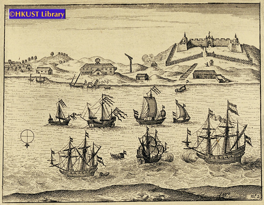
An engraving showing the settlement of Fort Zeelandia (安平古堡), ca.1631. It shows the four bastions of the fort (each surmounted by a tower), a wooden outer stockade (stone outer ramparts were not completed until 1633), and the warehouses and buildings of the adjacent settlement of Provintia.
By Isaac Commelin from his Begin ende voortgangh van de Vereenighde Nederlantsche Geoctroyeerde Oost-Indische Compagnie. Accompanies Zeyger van Rechteren’s description of his voyage to East Asia and Southeast Asia in 1629 as a Dutch East India Company doctor.
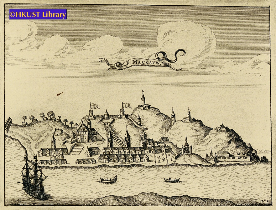
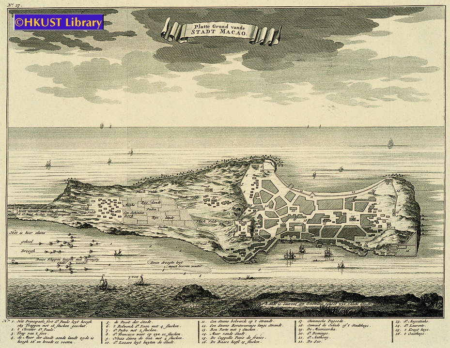
This engraving is the first available Dutch view of Macau. It shows the Cathedral Church of S. Paulo with its prominent steps, other monastery churches and fortifications, and the Temple of Ama (媽閣廟), still a popular tourist sight today.
By Isaac Commelin from his Begin ende voortgangh van de Vereenighde Nederlantsche Geoctroyeerde Oost-Indische Compagnie. Accompanies Zeyger van Rechteren’s description of his voyage to East Asia and Southeast Asia in 1629 as a Dutch East India Company doctor.
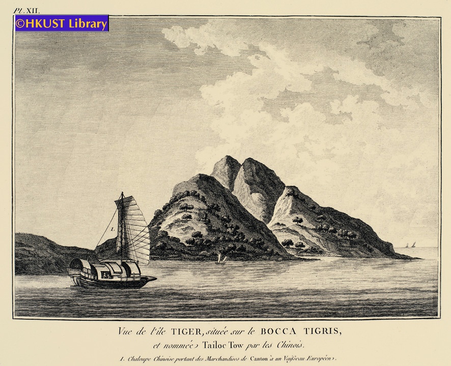
This engraving depicts a view of Tiger Island just to the North of the Bocca Tigris (虎門) with its distinctive cleft hillside. It also shows a Chinese junk and sampans.
View of the Pearl River based on observations made by John Meares during his first voyage to Hawaii and Guangzhou.
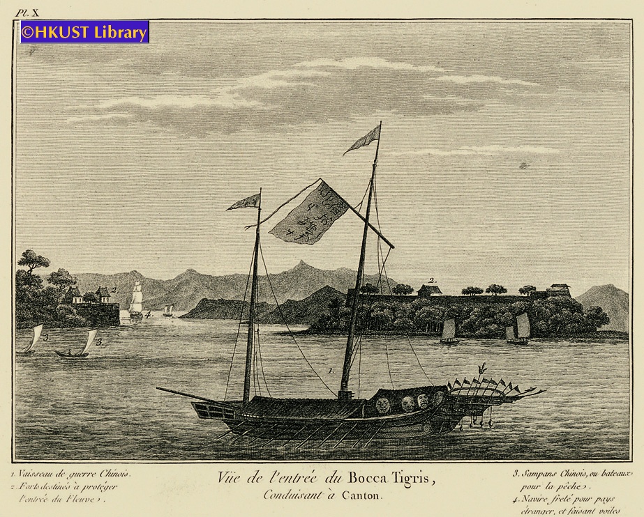
An engraving showing the Bocca Tigris (虎門) with the Chinese forts at Chuenpee (穿鼻) and Anunghoy (威遠島) on either side of the Estuary (later sites of battle in the Opium War). It also includes a fine drawing of a Chinese junk and sketches of sampans.
View of the Pearl River based on observations made by John Meares during his first voyage to Hawaii and Guangzhou.
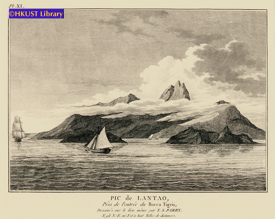
One of the first detailed Western depictions of Lantau Island (大嶼山) from observations made by a crewman ca. 1788.
View of the Pearl River based on observations made by John Meares during his first voyage to Hawaii and Guangzhou.
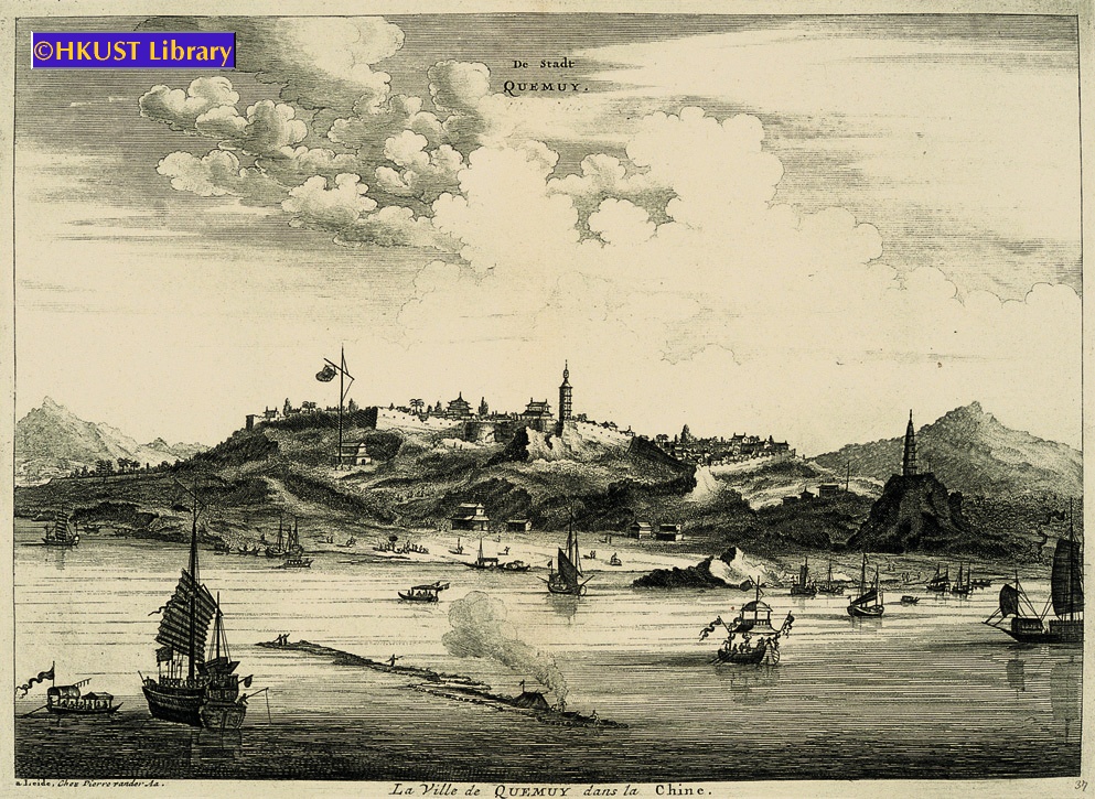
This detailed engraving shows the harbor of Quemoy (金門) with junks and sampans in the water, and city wall and buildings of the city on the top of the hill. Quemoy was an important trading post for the English and Dutch at the time.
Originally published in 1670 to accompany the account of Johannes Nieuhof’s Dutch Embassy to China in 1655. These are later re-engravings by Pieter van der Aa, published ca. 1729.
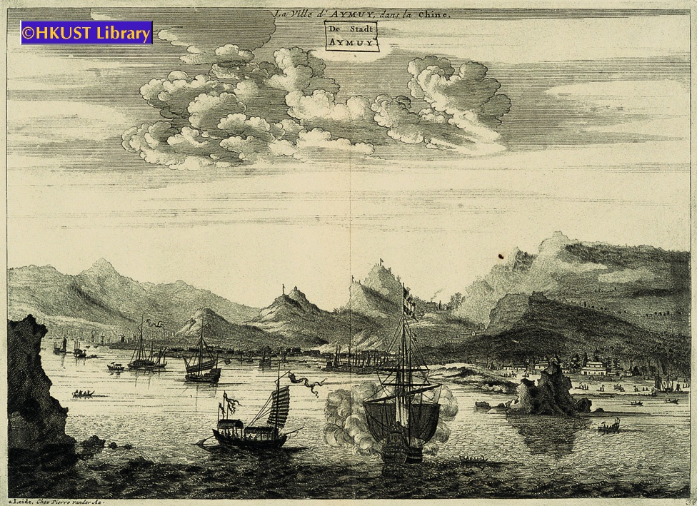
This engraving shows the harbor of Amoy (廈門) with junks and sampans in the water, houses along the coast, and rugged mountains in the background. Amoy was an important trading post for the English and Dutch at the time.
Originally published in 1670 to accompany the account of Johannes Nieuhof’s Dutch Embassy to China in 1655. These are later re-engravings by Pieter van der Aa, published ca. 1729.
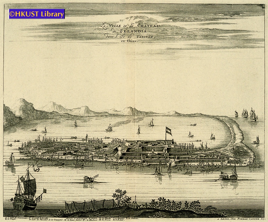
This engraving shows the Dutch fort and settlement of Zeelandia on the west coast of Taiwan. On the right is a curved sandy promontory with the castle and battlements; on the left is the town, while junks and sampans fill the water around the settlement. It was re-engraved by van der Aa in 1729, over 60 years after the Dutch were expelled by the Ming Loyalist, Koxinga (國姓爺鄭成功), and over 40 years after it was re-taken by the Qing.
Originally published in 1670 to accompany the account of Johannes Nieuhof’s Dutch Embassy to China in 1655. These are later re-engravings by Pieter van der Aa, published ca. 1729.
An engraved perspective map of Macau viewed from Lappa Island (對面山) but on a slightly larger scale extending to the Barrier Gate at the north of the promontory. Taken from Francois Valentyn’s Oud en Nieuw Oost Indien, a 5 volume encyclopedia on the Dutch East India Company’s empire, published 1724-1726.
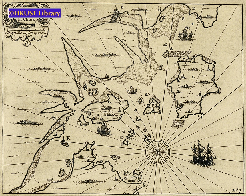
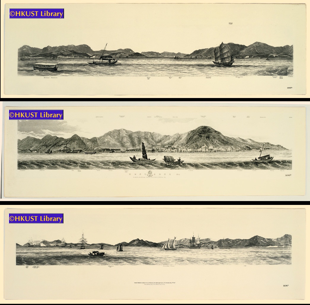
These three views can be connected to reflect one long panoramic view of the coast of Hong Kong, from the Kowloon peninsula to Hong Kong Island, then to Lantau Island (大嶼山) and Stonecutters Island (昂船洲), by Lieut. L. G. Heath of H.M.S. Iris.
9:15 am - 10:45 am
Lecture Theatre H
Prof. Zhang Longxi (張隆溪教授), Chair Professor of Comparative Literature and Translation & Director of Centre for Cross Cultural Studies, City University of Hong Kong
Mr. Roderick M. Barron, Antique Map Specialist, Kent, England
10:45 am - 11:30 am
HKUST Library
11:30 am - 1:00 pm
Lecture Theatre H
Prof. Fung Kam Wing (馮錦榮教授), Associate Professor, Department of Chinese, The University of Hong Kong. Director, The Chinese Society of the History of Science and Technology, Beijing, China
Mr. Jonathan A. Hill, Specialist in Rare Science Books, New York, N.Y.
University Library Gallery