


Special Collections at HKUST Library
During the early years of the University, extra funds were made available to the Library from time to time, providing an opportunity to develop special collections. We eventually selected Antique Maps of China and the History of Science and Technology as the two focus areas for our special collections. This is because they were, and still are, unique in this region and, therefore, fill a gap in scholarship.
The History of Science and Technology collection, with emphases on scientific discoveries and inventions in Europe during the past five hundred years, consists of about 530 volumes of rare books and over 1200 volumes of reference titles. Although this collection is modest in size, it offers an illuminating glimpse of the awesome achievements of the human intellect.
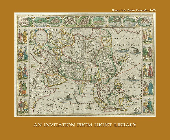
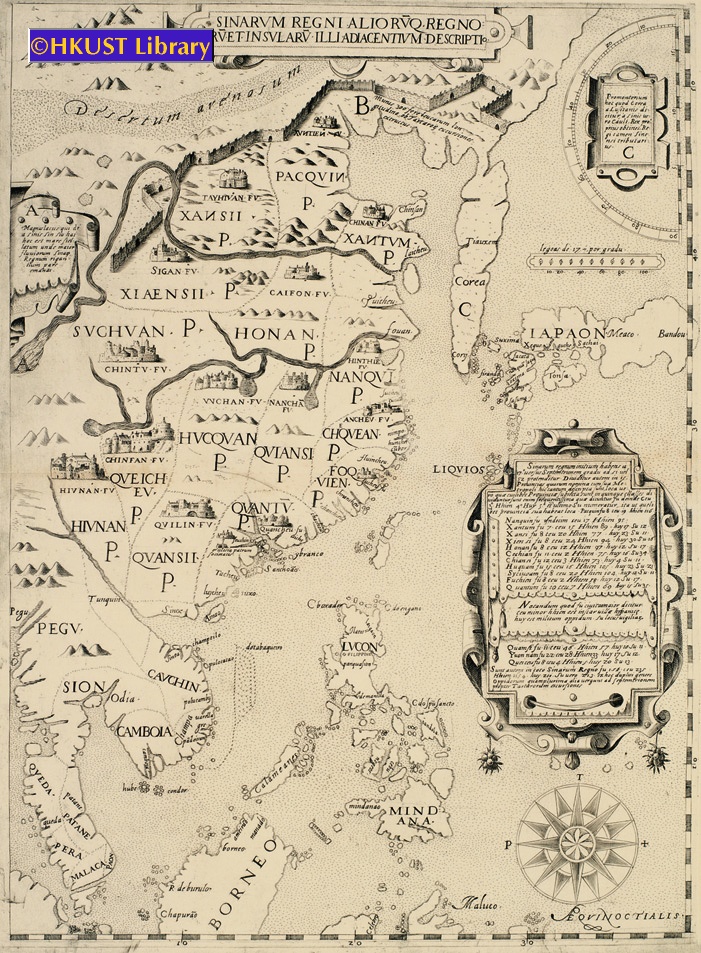
The Antique Maps of China collection includes more than 230 maps, charts, pictures, books and atlases. It represents almost all samples of China maps produced by European cartographers from the 16th to 19th centuries. This cartographic archive vividly records the long history of cross-cultural exchanges between China and the West.
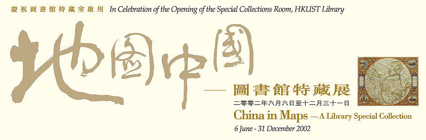
These two collections have been stored on compact shelvings with the University Archives until May 2002 when a permanent home befitting the intrinsic value and beauty of these items was completed. The new Special Collections Room furnished with Ming-style bookcases and cabinets will provide appropriate physical and environmental security for these works. Scholars will also have adequate space to view and use the collections. To celebrate the opening of the Special Collections Room, the Library mounted an exhibition on “China in Maps” and organized a Colloquium on “Celebrating Special Collections – Scholarship and Beauty”.
A copy of China Regnum (1593) and a set of postcards made from pictures in our Antique Maps of China collection, have been issued as mementos of this occasion.
Min-min Chang
University Librarian &
Curator of Special Collections
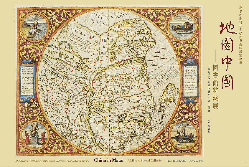
地圖中國 – 十六至十九世紀
這次展覽展出科大圖書館珍藏的古代地圖。地圖繪製日期由十六世紀到十九世紀,具有很高的藝術及歷史價值,從中可以看到古人對中國及附近區域地理環境的認識與日俱增。
展品包括著名地圖繪製家的製作。第一幅西方繪製的中國地圖出自奧特利烏斯手筆,以葡萄牙著名地圖繪製家巴布達的勘察為繪圖基礎,一五八四年在比利時安特衛出版。十年之後,林索登參照葡萄牙航海家的報告,在阿姆斯特丹出版了這個地區的航海圖,是當時最具權威的同類航海圖之一,也是以印刷方式紀錄當時葡萄牙人對中、日海岸線研究的最早期文獻之一。
一五八二年到達澳門的利瑪竇,對歐州的中國地圖學影響深遠。他最出色的作品,是一六零二年在北京繪製的多頁掛牆萬國輿圖。他沿著亞州的太平洋海岸畫下地圖的本初子午線,中國於是仍然佔據世界的中央位置。一六五五年,荷蘭地圖製作家布洛出版了意大利耶穌會教士馬提尼繪的《中國地圖》,也是一份重要文獻。事實上,耶穌會教士在中國地圖繪製學上一直貢獻良多,十七世紀末葉意大利科羅內尼的作品就是明證。
馬提尼的《中國地圖》繪製後將近一百年,才出現新一代的地圖。一七一八年,耶穌會教士應中國國君之請,重新考察了中國的地理環境,達安維爾據他們考察的結果,繪成一七三七年出版的《最新中國輿圖》。這些地圖載有中國邊遠地區的詳細考察資料,其中的高麗地圖,是高麗獨立成圖的最早期作品之一;而其西藏、不丹地圖,也是這兩個地區見於西方印刷的最早期作品。
十七世紀末,由於英國東印度公司藉著澳門這個葡萄牙殖民地和廣州發展茶葉貿易,珠江三角洲地圖的繪製更趨準確。又一八四一年香港開始發展,加上十九世紀三十年代末葉至六十年代初葉中國與歐洲列強多次衝突,進一步促進了航海圖以及珠江口要點地圖[特別是廣州地圖]的繪製工作。此外,一八四三至四四年中國根據條約把沿岸的廈門、福州、寧波、上海劃為港口,也刺激起繪製中國沿岸地圖的興趣。
我們希望這些深具史學、地圖學價值的文獻,憑其清楚生動的圖像,能夠幫助現在和未來的學生進一步了解中西文化交流的悠長歷史。
HKUST Library Exhibition Postcard Series, No. 5
In Celebration of the Opening of the Special Collections Room, HKUST Library
Hong Kong Etc. as Seen from the Anchorage, 1846
An extremely rare engraved map, centered on China, but showing the Malay Peninsula, Northern Borneo, the Philippines, the Korean Peninsula, and Japan. Interesting features include the Great Wall, an accurate depiction of the course of the Yellow River, delineations of the 15 Provinces, and an inserted table showing different administrative and regional divisions in each Province. Anonymous (possibly after Matteo Ricci & Michele Ruggieri).
An engraved map of the Bay of Amoy (廈門) in Fujien Province. It is one of the earliest detailed Western charts to depict the coast of China.
By Isaac Commelin from his Begin ende voortgangh van de Vereenighde Nederlantsche Geoctroyeerde Oost-Indische Compagnie. Accompanies Zeyger van Rechteren’s description of his voyage to East Asia and Southeast Asia in 1629 as a Dutch East India Company doctor.
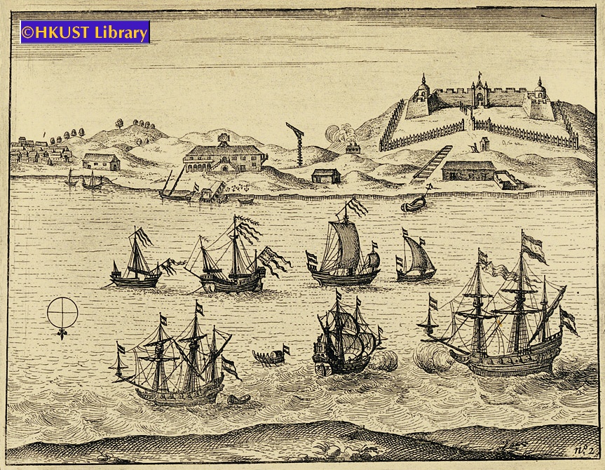
An engraving showing the settlement of Fort Zeelandia (安平古堡), ca.1631. It shows the four bastions of the fort (each surmounted by a tower), a wooden outer stockade (stone outer ramparts were not completed until 1633), and the warehouses and buildings of the adjacent settlement of Provintia.
By Isaac Commelin from his Begin ende voortgangh van de Vereenighde Nederlantsche Geoctroyeerde Oost-Indische Compagnie. Accompanies Zeyger van Rechteren’s description of his voyage to East Asia and Southeast Asia in 1629 as a Dutch East India Company doctor.
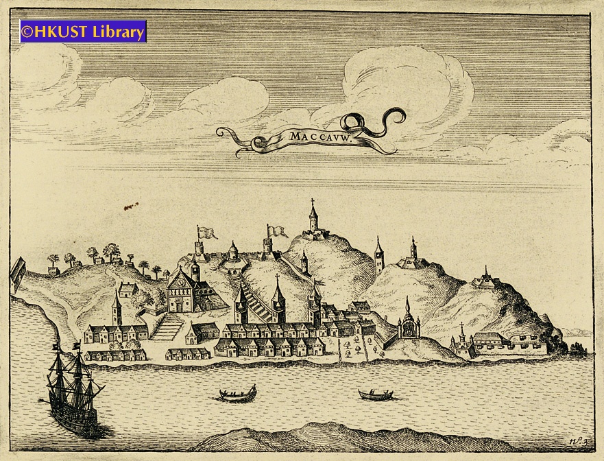
This engraving is the first available Dutch view of Macau. It shows the Cathedral Church of S. Paulo with its prominent steps, other monastery churches and fortifications, and the Temple of Ama (媽閣廟), still a popular tourist sight today.
By Isaac Commelin from his Begin ende voortgangh van de Vereenighde Nederlantsche Geoctroyeerde Oost-Indische Compagnie. Accompanies Zeyger van Rechteren’s description of his voyage to East Asia and Southeast Asia in 1629 as a Dutch East India Company doctor.
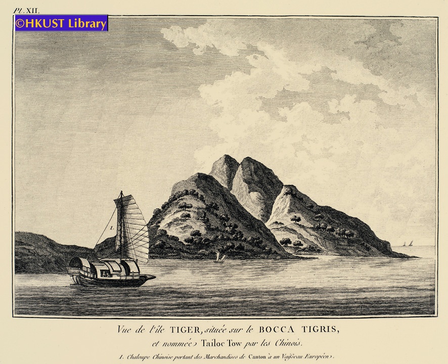
This engraving depicts a view of Tiger Island just to the North of the Bocca Tigris (虎門) with its distinctive cleft hillside. It also shows a Chinese junk and sampans.
View of the Pearl River based on observations made by John Meares during his first voyage to Hawaii and Guangzhou.
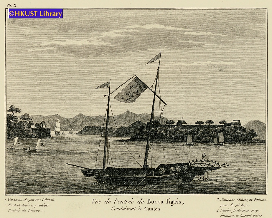
An engraving showing the Bocca Tigris (虎門) with the Chinese forts at Chuenpee (穿鼻) and Anunghoy (威遠島) on either side of the Estuary (later sites of battle in the Opium War). It also includes a fine drawing of a Chinese junk and sketches of sampans.
View of the Pearl River based on observations made by John Meares during his first voyage to Hawaii and Guangzhou.
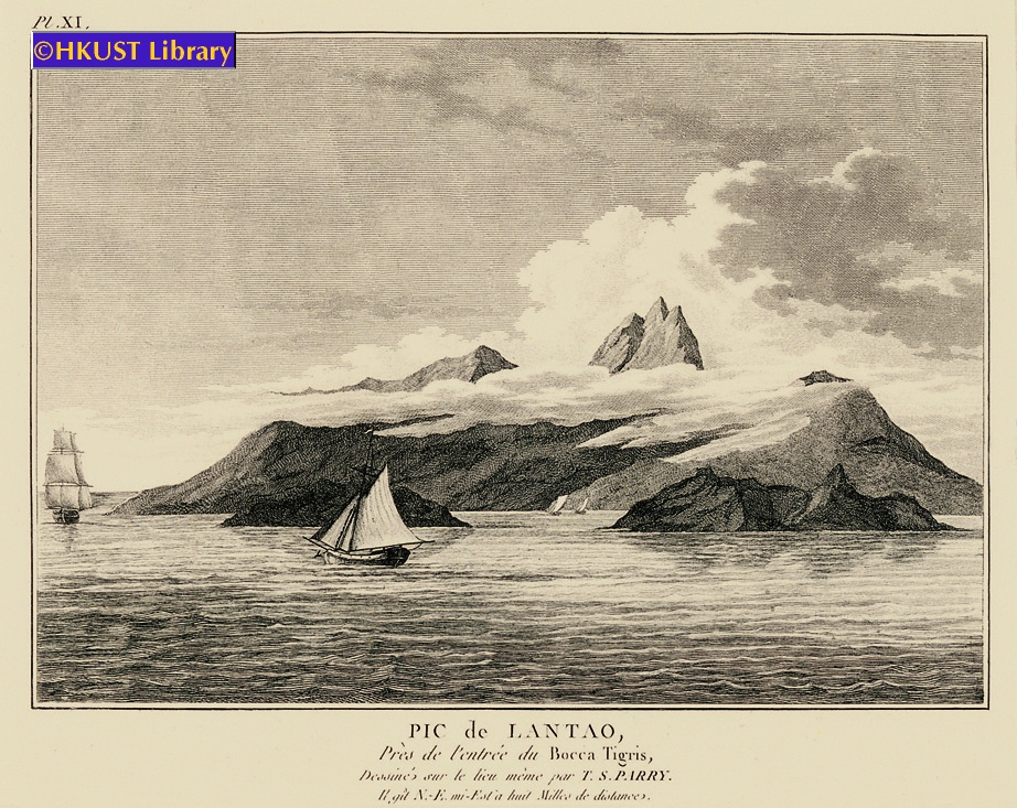
One of the first detailed Western depictions of Lantau Island (大嶼山) from observations made by a crewman ca. 1788.
View of the Pearl River based on observations made by John Meares during his first voyage to Hawaii and Guangzhou.
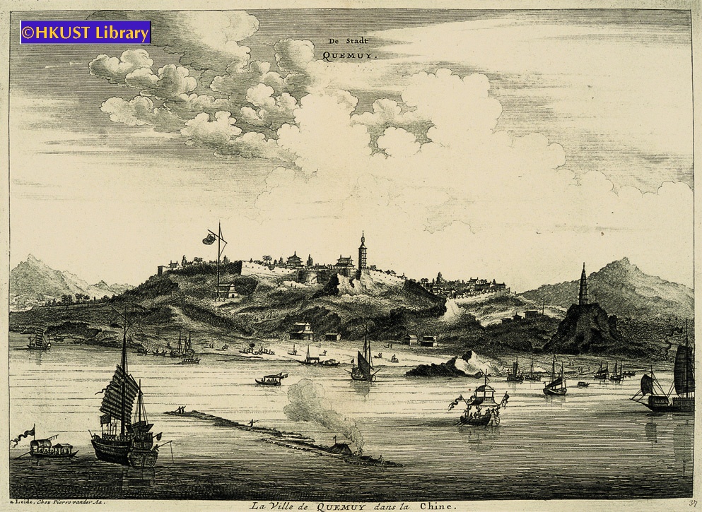
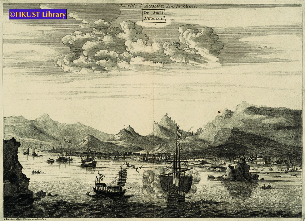
This detailed engraving shows the harbor of Quemoy (金門) with junks and sampans in the water, and city wall and buildings of the city on the top of the hill. Quemoy was an important trading post for the English and Dutch at the time.
Originally published in 1670 to accompany the account of Johannes Nieuhof’s Dutch Embassy to China in 1655. These are later re-engravings by Pieter van der Aa, published ca. 1729.
This engraving shows the harbor of Amoy (廈門) with junks and sampans in the water, houses along the coast, and rugged mountains in the background. Amoy was an important trading post for the English and Dutch at the time.
Originally published in 1670 to accompany the account of Johannes Nieuhof’s Dutch Embassy to China in 1655. These are later re-engravings by Pieter van der Aa, published ca. 1729.
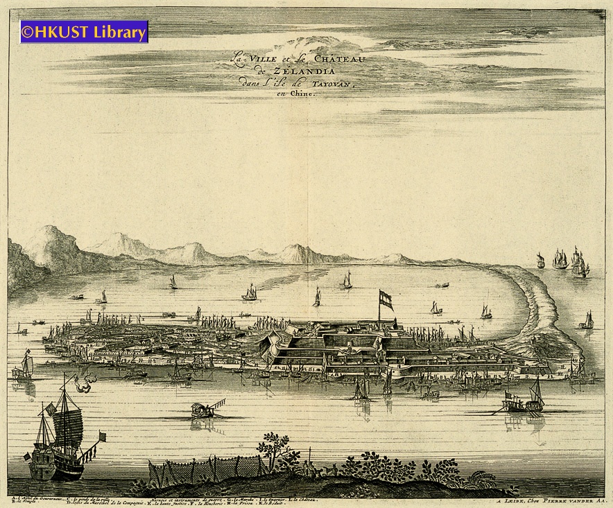
This engraving shows the Dutch fort and settlement of Zeelandia on the west coast of Taiwan. On the right is a curved sandy promontory with the castle and battlements; on the left is the town, while junks and sampans fill the water around the settlement. It was re-engraved by van der Aa in 1729, over 60 years after the Dutch were expelled by the Ming Loyalist, Koxinga (國姓爺鄭成功), and over 40 years after it was re-taken by the Qing.
Originally published in 1670 to accompany the account of Johannes Nieuhof’s Dutch Embassy to China in 1655. These are later re-engravings by Pieter van der Aa, published ca. 1729.
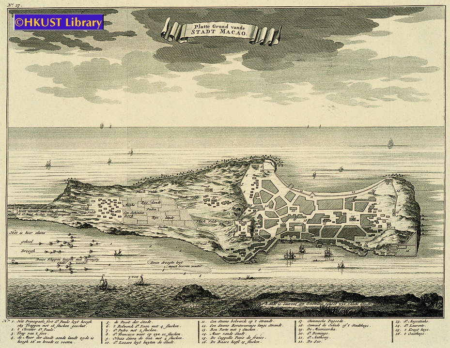
An engraved perspective map of Macau viewed from Lappa Island (對面山) but on a slightly larger scale extending to the Barrier Gate at the north of the promontory. Taken from Francois Valentyn’s Oud en Nieuw Oost Indien, a 5 volume encyclopedia on the Dutch East India Company’s empire, published 1724-1726.
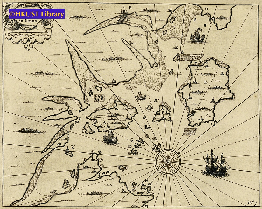
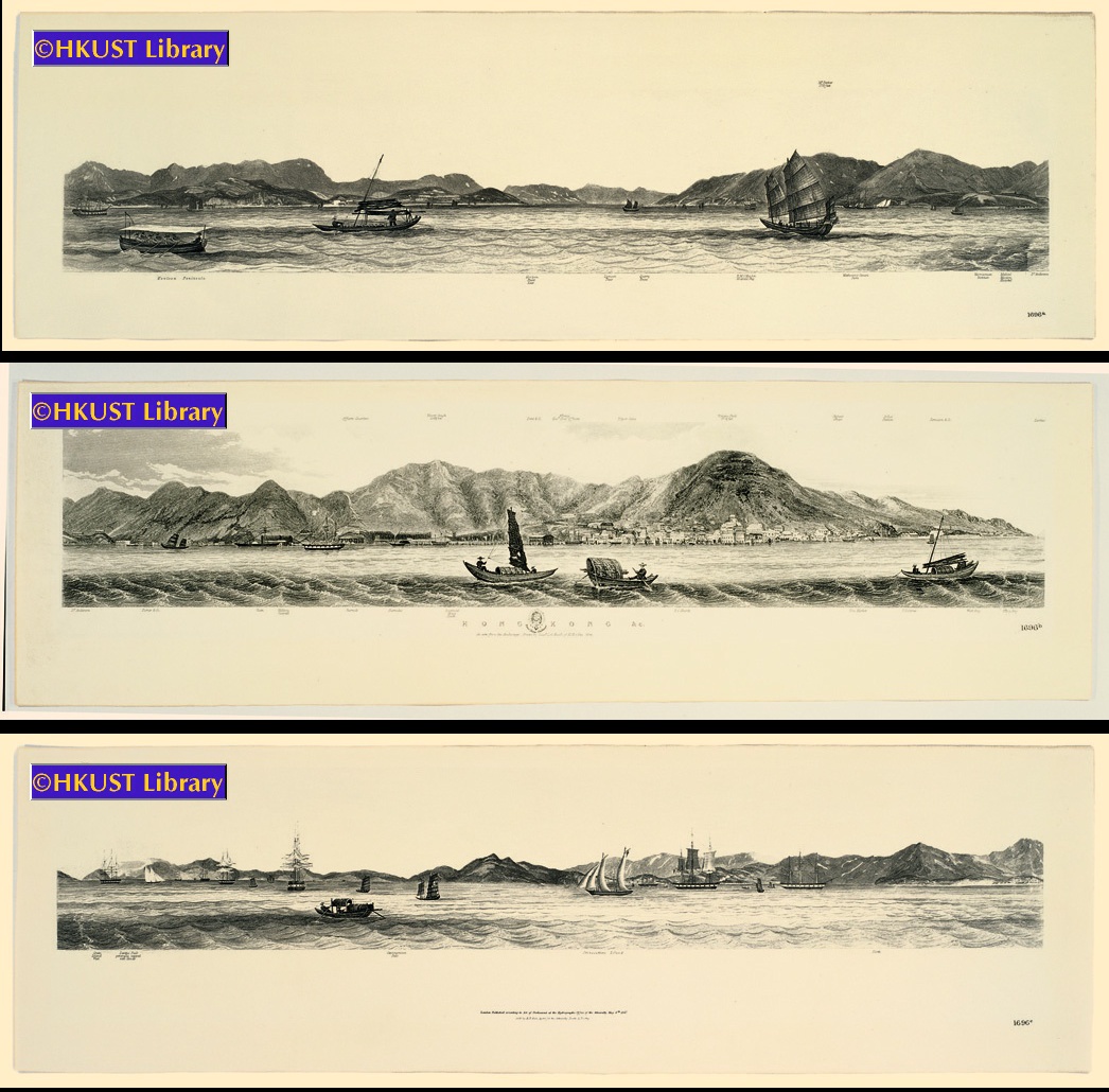
These three views can be connected to reflect one long panoramic view of the coast of Hong Kong, from the Kowloon peninsula to Hong Kong Island, then to Lantau Island (大嶼山) and Stonecutters Island (昂船洲), by Lieut. L. G. Heath of H.M.S. Iris.
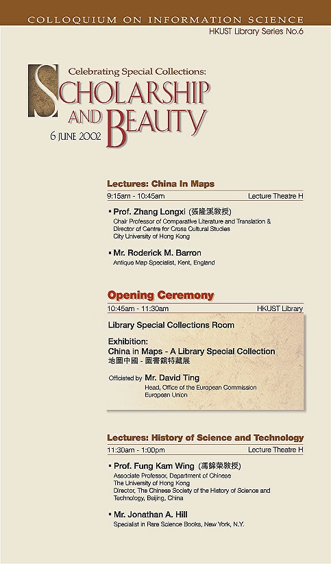
9:15 am - 10:45 am
Lecture Theatre H
Prof. Zhang Longxi (張隆溪教授), Chair Professor of Comparative Literature and Translation & Director of Centre for Cross Cultural Studies, City University of Hong Kong
Mr. Roderick M. Barron, Antique Map Specialist, Kent, England
10:45 am - 11:30 am
HKUST Library
11:30 am - 1:00 pm
Lecture Theatre H
Prof. Fung Kam Wing (馮錦榮教授), Associate Professor, Department of Chinese, The University of Hong Kong. Director, The Chinese Society of the History of Science and Technology, Beijing, China
Mr. Jonathan A. Hill, Specialist in Rare Science Books, New York, N.Y.