


Writing the text for the project Tales from a 1493 World Map: Playing with Augmented Reality (AR) was meant to be a straightforward task - just a bit of history, a touch of mythology, and voilà, a finished story. In reality, it turned into a full-scale expedition through time, culture, and a bestiary of fantastical creatures that make Godzilla seem downright tame. Though my journalism background prepared me for chasing deadlines and digging for facts, tackling a 1493 German medieval map brimming with monsters borrowed from Greek, Roman, and other mythologies was an entirely different challenge. Let’s just say neither history nor myth was accompanied by a user guide. For an entire month, Tory, the Head of the library’s Research & Learning Support, and I became part-time historians and mythical creature specialists. We scoured the HKUST library as if it were a treasure trove, navigating dusty tomes and digital archives from museums across Europe and North America. We encountered ancient manuscripts, encyclopedias, and artistic interpretations that looked like the creative output of medieval monks during a very long sermon. The greatest challenge? Distinguishing fact from fiction - or, as I came to call it, playing medieval myth-whack-a-mole. One source portrayed a beast as a noble fire-breather; another insisted it was merely an irritable lizard with attitude problems.
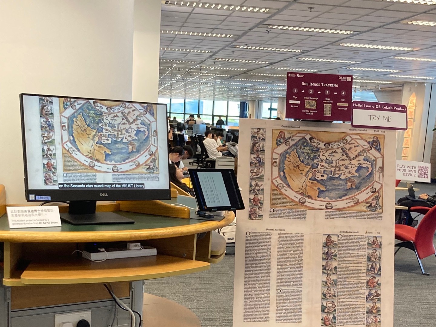
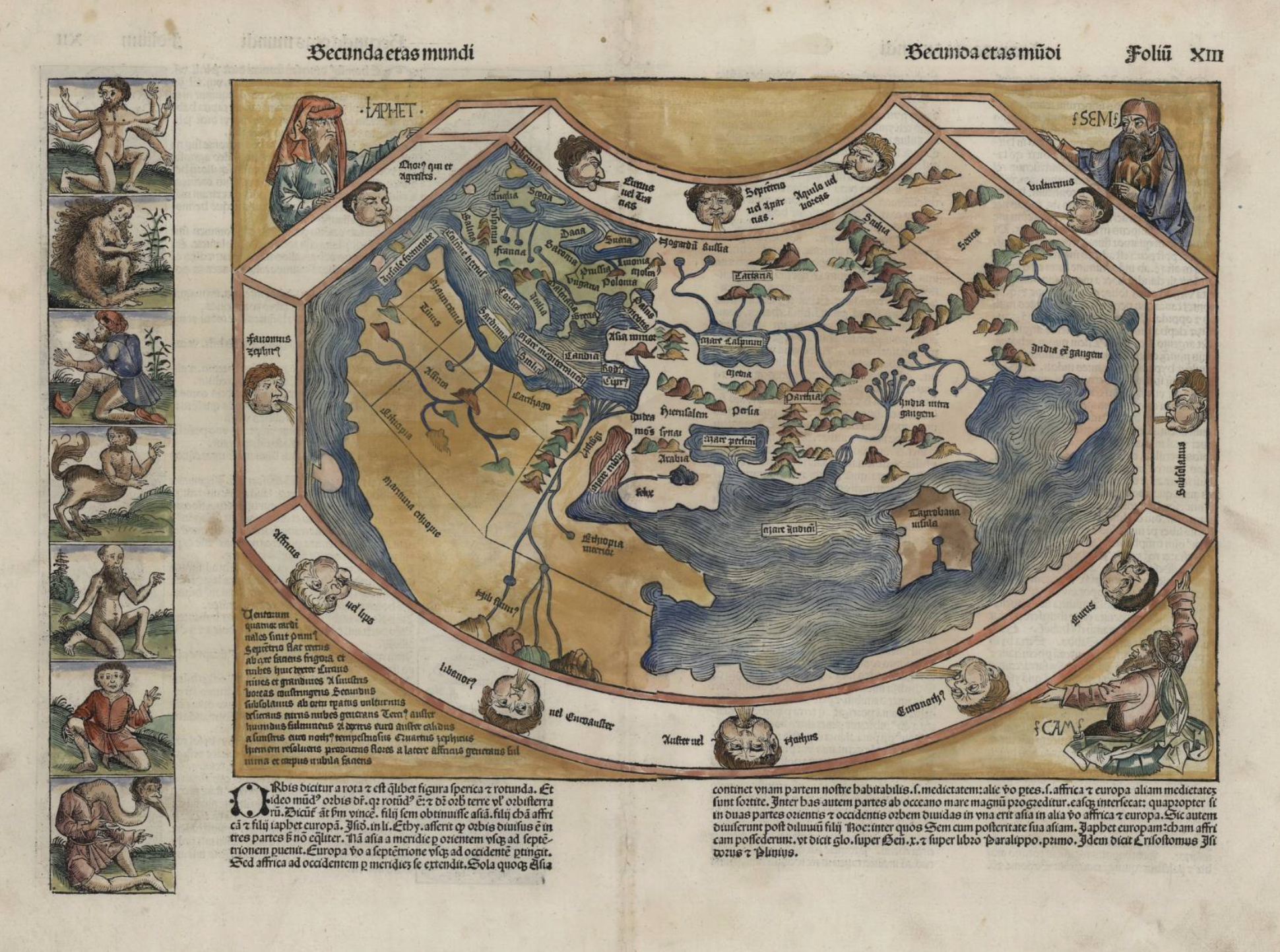
What's Up on the Ground Floor this September? You may have noticed something unusual just inside the G/F gates of the Library. What is it? A display of a digital humanities project for you to interact (play) with. What's the story? In spring semester 2025, 5 UG students worked with library staff as one of the DS CoLab projects to bring a 520 year-old map from the Library's collection to life. They used augmented reality (AR) technology to create an engaging and interactive visual way to explore the cultures and histories that went into the creation of "Secunda etas mundi", The Second Stage of the World, from Hartmann Schedel's Nuremberg Chronicle (1493). This map is a fascinating piece from the library’s Special Collections. It shows “The Second Age of the World” (out of 6), the stage between Noah’s Flood and the birth of Abraham. These ages were a periodization of world history (common in Christian Europe for about 1,000 years), first formulated by the North African Christian theologian, Augustine of Hippo (354-430 CE). A remarkable example of late medieval cartography, it combines knowledge from the Greek geographer Claudius Ptolemy with visual references from religion and mythology from Europe and the lands surrounding the Mediterranean.
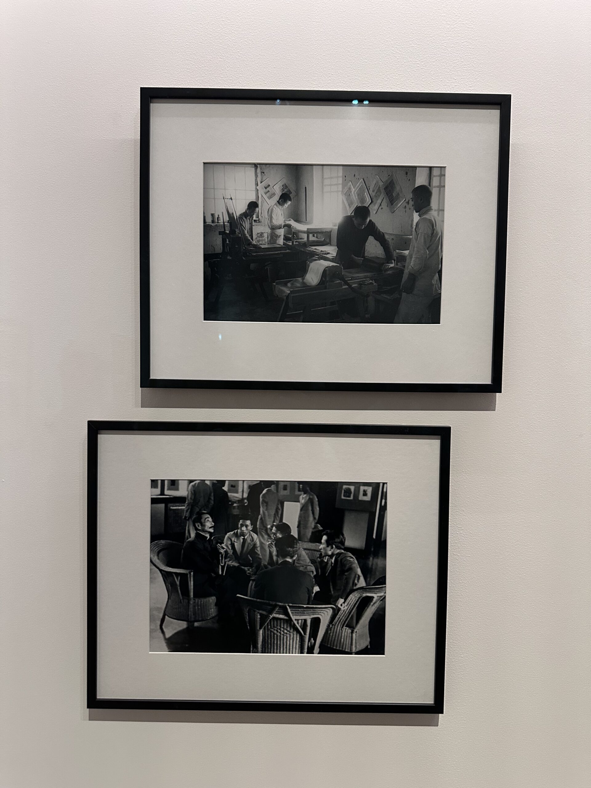
Did you know that Canton (Guangzhou) and Hong Kong, twin cities where Cantonese is the lingua franca, have much more in common beyond language? Modern art and visual culture born in the two cities share a legacy deeply rooted in the history of Modern China. M Museum’s recent exhibition “Canton Modern: Art and Visual Culture 1900s-1970s” showcases over 200 artworks – many on public display for the first time – from this lesser-known history. Sha Fei, a featured artist in this exhibition whose works are on loan from our Library’s Special Collections, is regarded as one of the most influential Chinese photographers of the 20th century. Born and educated in Guangzhou, Sha Fei, originally named Situ Chuan, came from an extended family that was well known for its artistically talented members, including a film director and two painters. Initially aspired to be a fine art photographer, Sha Fei turned his lens towards the working class and later, scenes of war during the 1930s-40s. This transformation was driven by a shared artistic vision among Cantonese artists highlighted in the M exhibition: the belief that art could influence people and transform society. Two of Sha Fei’s works on display at M , photos taken by the author. As a photojournalist, Sha Fei produced more than a thousand photo records of the Sino-Japanese War. Thanks to a generous donation from Sha Fei’s daughter, Ms Wang Yan, who reached us through Professor David Cheng Chang at the Division of Humanities, our Library now holds a collection of Sha Fei’s wartime photographs: Sha Fei Photographic Collection.
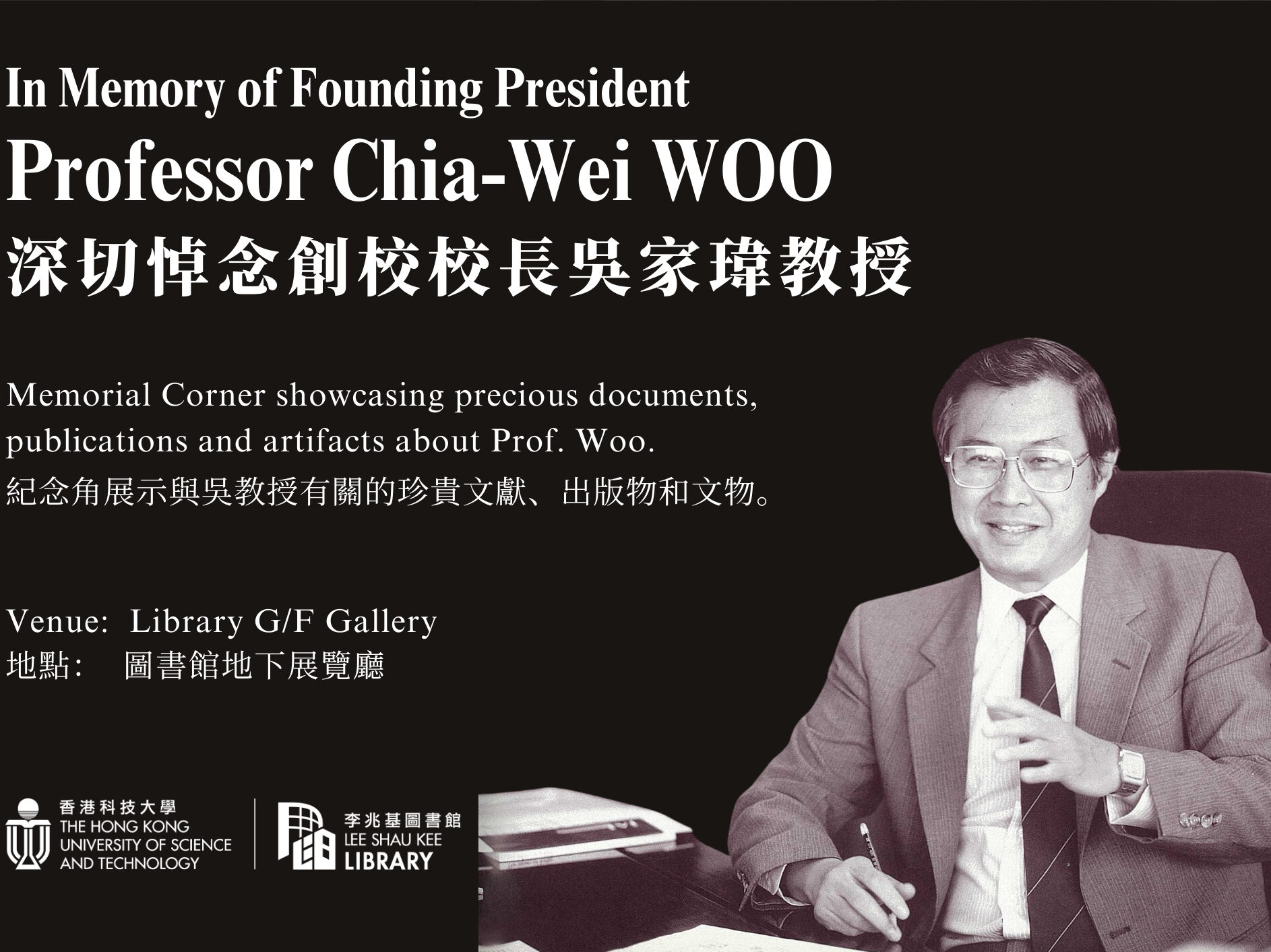
In a remarkable team effort, the University Archives recently completed installation of a memorial corner dedicated to our late founding president, Prof. Chia-Wei Woo. Did you know that it was Prof. Woo’s vision back in 1990 to establish a university archive for preserving historically significant materials relating to our university? This memorial corner could not showcase such valuable materials without his foresight and commitment to safeguarding our university's history. Within a week of announcing Prof. Woo's passing, our dedicated team collaborated to plan, design, prepare, and assemble a small display at the Library G/F Gallery to honor his memory. Our first step involved selecting items that best reflect Prof. Woo’s connection with the university and his visionary values. Among the treasures selected are three important letters from 1985 and 1987 that mark his appointment as founding president and the university’s founding years.
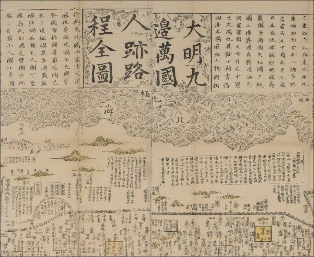
Old maps are visually beautiful; and they carry a lot of interesting stories. The Library hosted a 3-day research symposium last December with map historians from local and overseas institutions. One really memorable talk in the symposium was about this famous Chinese map dated 1644, the year the Ming Empire collapsed: <天下九邊分野人跡路程全圖> (A comprehensive map of the kingdom of China and neighbouring countries). The speaker, Professor Mario Cams of KU Leuven (Belgium), explained that this fascinating map was a hybrid of Chinese and European mapmaking; he told the interesting threads of history in a century of east-west exchanges that led to this map. We do not have a copy of this rare map, but you can find a similar one printed in the 18th Century in our Special Collections. You can examine the image of the 1644 map at this site: look for the latitude scale, north and south poles, Europe, North and South Americas (separated); these are the typographical knowledge from the West, and are scattered around the edges of the map. However, the bulk of the map in the middle is the Ming Empire administration, which is not intended to represent geographical reality. To weave the story of the map, Professor Cams started in 1555, the era when 2 Chinese maps from Fujian travelled to Europe via merchants in Southeast Asia. Afterwards, Jesuit missionaries brought European geographic knowledge to the East, forming the basis of this "hybrid map". An important thread in the story is the Ming book publishing culture.
