


Project Acquisitions
These acquisitions were made possible through the Western Maps of China Project, which was generously supported by a donation from Dr. Ko Pui Shuen.
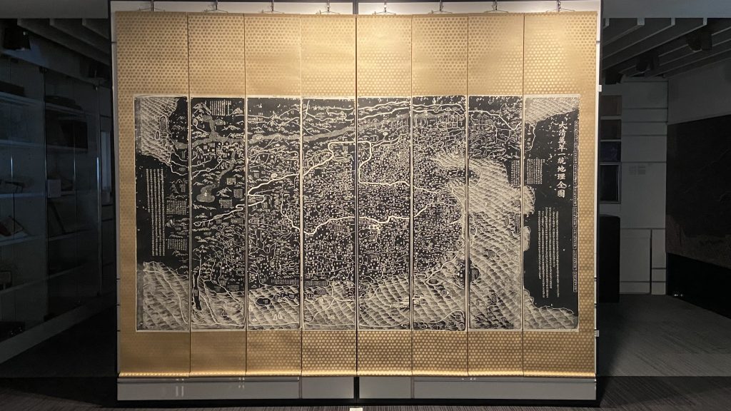
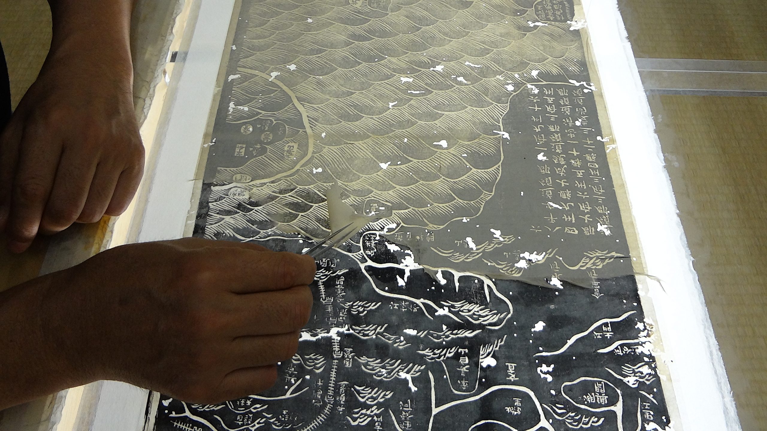
The Black Map (Da Qing Wan Nian Yi Tong Dili Quan Tu)
An extraordinarily rare cartographic document that is based on research originally presented to the Qianlong emperor by Huang Qianren 黃千人 (fl. 1760 – 1770) in 1767. The title of the map is as much a political programme of the Qing as it is a geographical record. It shows China at the height of the Qing empire, celebrating the unified status of all of Chinese borders.
The map was designed to act not only as a grand political statement of the Kingdom’s place in the world, but also as an administrative tool. Its surface is dotted with provincial capitals (sheng 省), a square with a small rectangle on top; prefectures (fu 府), a square; independent district magistrates (zhilizhou直隸州), a square with a triangle on top; departments (zhou州), a vertical rectangle; sub-prefectures (ting廳), a diamond; districts (xian縣), a circle; frontier passes (guan關), a small building; local headmen or western tribute states (tusi土司), a triangle; with the name appearing within each pictogram. The borders of each province are denoted by dotted lines.
大清萬年一統地理全圖
這幅極為罕見的地圖是根據黃千人(1697年至1770年)於乾隆丁亥年 (公元1767年)向乾隆皇帝匯報的舊圖增補而成。此圖的標題既點出清朝的政治綱領,同時亦是清朝的地理記錄,展示了中國在清帝國的鼎盛時期國內統一及邊界安定。
製成此圖的目的不僅是作為清帝國彰顯於世界中心的宏偉政治聲明,同時亦具備行政工具的作用。地圖上遍佈不同圖形代表的各地區行政單位:內有長方形的方格代表省;一個正方形代表府;直隸州是上有三角形的方格;州是垂直矩形;廳是菱形;縣是圓形;關口以小屋代表;土司是三角形。每個位置所屬的名稱均出現在圖形中,而每個省的邊界則以虛線表示。位處地圖左上方是地中海(小西洋)以及大西洋,其中荷蘭和英國被描繪為大西洋中的島嶼。
Yu Ji Tu
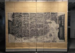
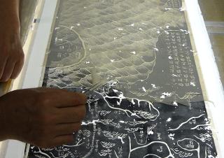
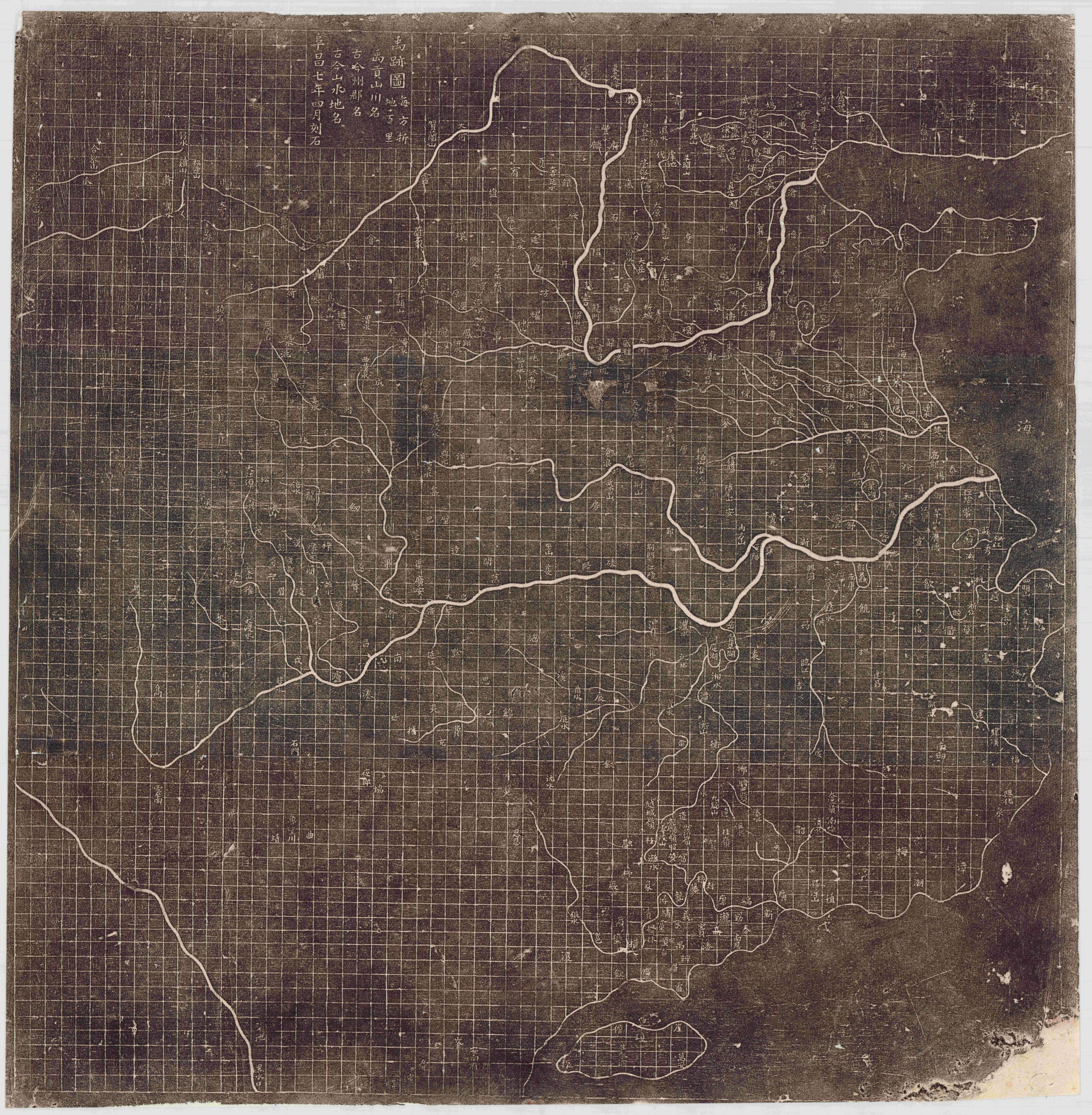
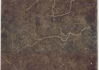
Our most recent acquisition, and the earliest map in our collection– this is a 19th century Chinese rubbing of the Southern Song Dynasty 1137 Yu Ji Tu 禹跡圖, or Map of the Tracks of Yu Gong, from the original stone carving in Xian. It is a milestone in the history of science and the most accurate map produced anywhere at that time.
It shows which level of geographical knowledge was available in China before the contact with the West. The Yu Ji Tu is one of the earliest and most important Chinese maps ever produced. Issued at a time when European cartographers were focused on religious symbolism more than geographic realism, this Chinese map exhibits a cartographic accuracy and meticulousness comparable to 20th century mapmaking. This is the earliest map to employ a rectilinear grid system.
Read more on georeferencing the Yu Ji Tu – “Yu laid out the lands”: georeferencing the Chinese Yujitu [Map of the Tracks of Yu] of 1136 (with Alexander Akin), Cartography and Geographic Information Science Journal, 2012.
Digital reprint available from Prof. David Mumford’s website.
禹跡圖
圖書館近期的新增館藏、同時為特藏最古舊的一幅地圖-禹跡圖。禹跡圖於19世紀由石碑墨托而成。該石碑刻於南宋1137年,現存於西安,為當時世上最精準的地圖。
禹跡圖展現了中國與西方交流前的製圖技術水平,是其中一幅最早製成和最重要的中國地圖,其發行時間恰逢歐洲製圖學家更關注於宗教象徵主義而非地理現實主義的時代。此圖展現了足可媲美20世紀製圖的準確性和細緻度, 亦是最早採用計里畫方的地圖。
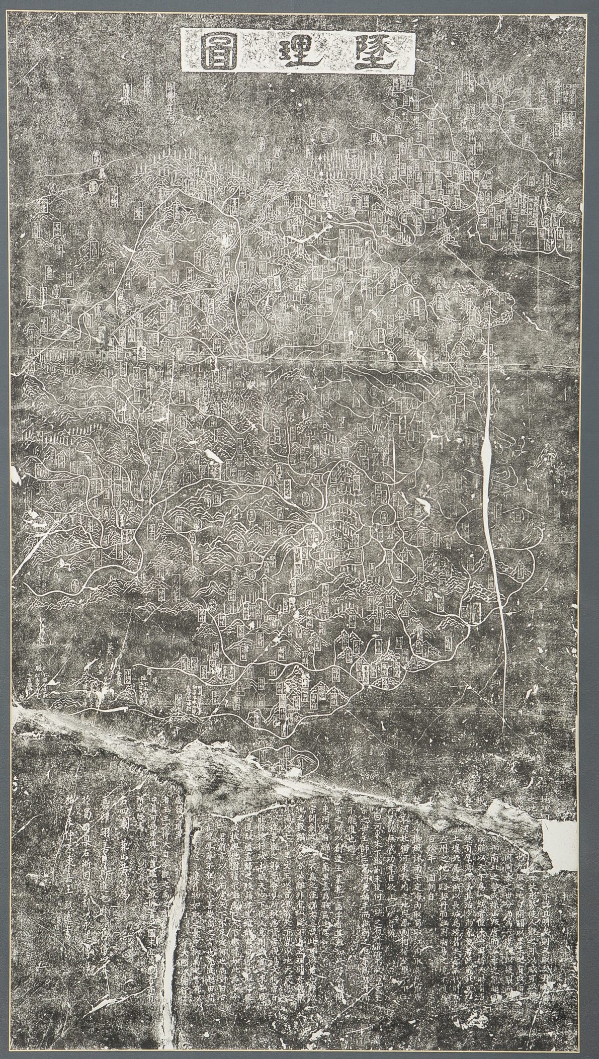
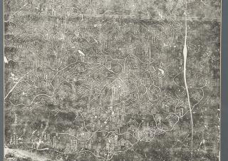
Dili Tu
The Dili Tu 墬理圖 [Geographic Map of China] was engraved in 1247 on a stone stele now kept in the Museum of Engraved Stone Tablets at the Suzhou Confucian Temple. This is a rubbing of the original stone made in the early 20th century and mounted on a scroll.
In this map, China is laid out on the top two-thirds of the rubbing, with hundreds of settlements shown in oval and rectangle cartouches. Mountains, hills, and forests are elegantly added in among the characters, with China’s many rivers flowing throughout. The bottom third of the rubbing is filled with notes describing not only the geography, but also the history of China. The thrust of the narrative discusses the perennial fragmentation and reunification of the empire and the need for the Southern Song dynasty to fight to reconquer the North.
See transcription and translation.
墬理圖
墬理圖於 1247 年上石,該石碑現在保存在蘇州孔廟石碑博物館中。這是20世紀初期的托本,並裝裱在捲軸上。
在此地圖中,中國佔據了三分之二的畫面,橢圓形和長方形的裝飾上顯示了數百個定居點。 地名方塊之間優雅地添加了山脈,丘陵和森林,中國的許多河流都流淌在其中。底部的三分之一為註釋,這些註釋不僅描述了地理,而且描述了中國的歷史。敘述了帝國的長期分裂和統一以及南宋王朝為征服北方而戰的人。
查看碑文
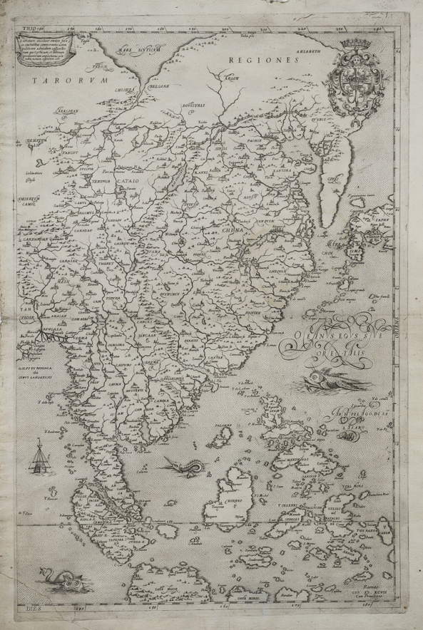
Rughesi map of East Asia
This map is the eastern part of a 1597 map of Asia by the Italian cartographer Fausto Rughesi. As well as being extremely rare (only 3 other copies are known) it contains significant new cartographic information for China, Korea and Japan, probably derived from Jesuit sources, recently transmitted to Rome.
It is only the second printed map to show Korea as a peninsula rather than an island and it has the most detailed rendering of the Middle Kingdom to appear on any known printed map to date.
盧格西地圖
此地圖是意大利製圖師盧格西(Fausto Rughesi)於1597年繪製的亞洲地圖的東部。除了極為罕有見(已知僅有三份複本)外,它還包含了中國、韓國和日本的重要製圖信息,這些信息可能通過耶穌會傳送至羅馬。
它是第二張將朝鮮顯示為半島而不是島嶼的印刷地圖,並具有迄今為止最詳盡描繪的中土帝國。