


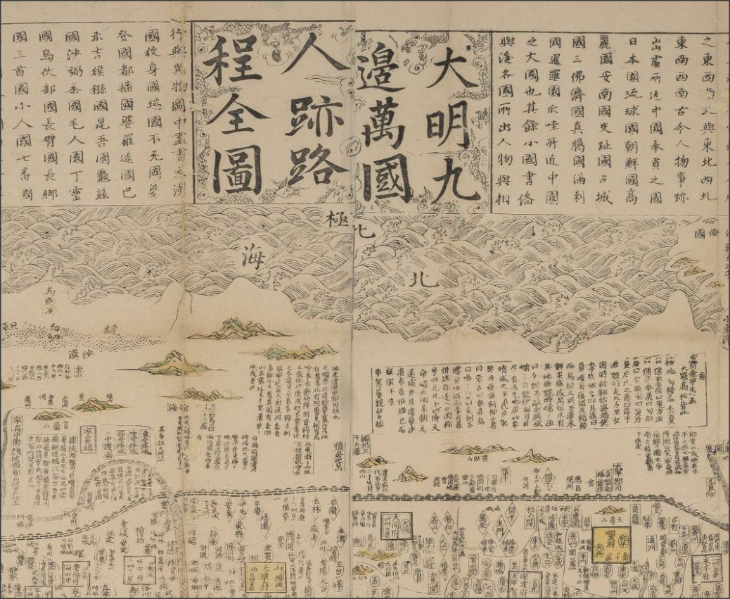
Old maps are visually beautiful; and they carry a lot of interesting stories. The Library hosted a 3-day research symposium last December with map historians from local and overseas institutions. One really memorable talk in the symposium was about this famous Chinese map dated 1644, the year the Ming Empire collapsed: <天下九邊分野人跡路程全圖> (A comprehensive map of the kingdom of China and neighbouring countries). The speaker, Professor Mario Cams of KU Leuven (Belgium), explained that this fascinating map was a hybrid of Chinese and European mapmaking; he told the interesting threads of history in a century of east-west exchanges that led to this map. We do not have a copy of this rare map, but you can find a similar one printed in the 18th Century in our Special Collections. You can examine the image of the 1644 map at this site: look for the latitude scale, north and south poles, Europe, North and South Americas (separated); these are the typographical knowledge from the West, and are scattered around the edges of the map. However, the bulk of the map in the middle is the Ming Empire administration, which is not intended to represent geographical reality. To weave the story of the map, Professor Cams started in 1555, the era when 2 Chinese maps from Fujian travelled to Europe via merchants in Southeast Asia. Afterwards, Jesuit missionaries brought European geographic knowledge to the East, forming the basis of this "hybrid map". An important thread in the story is the Ming book publishing culture.

The value of research data can go way beyond the project for which it is created. Well-managed data can optimize it’s re-usability and research reproducibility; it also helps researchers to demonstrate good research practice and integrity.
