Mapping East Asia in Context Symposium
The symposium will bring together scholars from across the globe, to reflect on the state of the field with maps of East Asia produced between 1300 to 1800 drawn by Chinese, Korean and European mapmakers, focusing on the circulation of cartographic knowledge both within East Asia and from East Asia to Europe.
- Date: 6-8 December, 2023
- 6 December: Public Talks
- 7 December: Workshop
- 8 December: Public Talks
- Venue: LG4, Multi-Function Room, HKUST Library, Hong Kong
For enquiry, please contact University Archives & Special Collections at lbarsc@ust.hk.
Symposium Photos


Acknowledgement
The symposium is co-organized with École française d’Extrême-Orient (EFEO), Institute of Chinese Studies, CUHK and Division of Humanities, HKUST, and is funded by Dr. Ko Pui-shuen under the Western Maps of China Project.
![]()
![]()
The Backgrounds of the Chinese Maps: Their Reading and Understanding
Public Lecture Series
 |
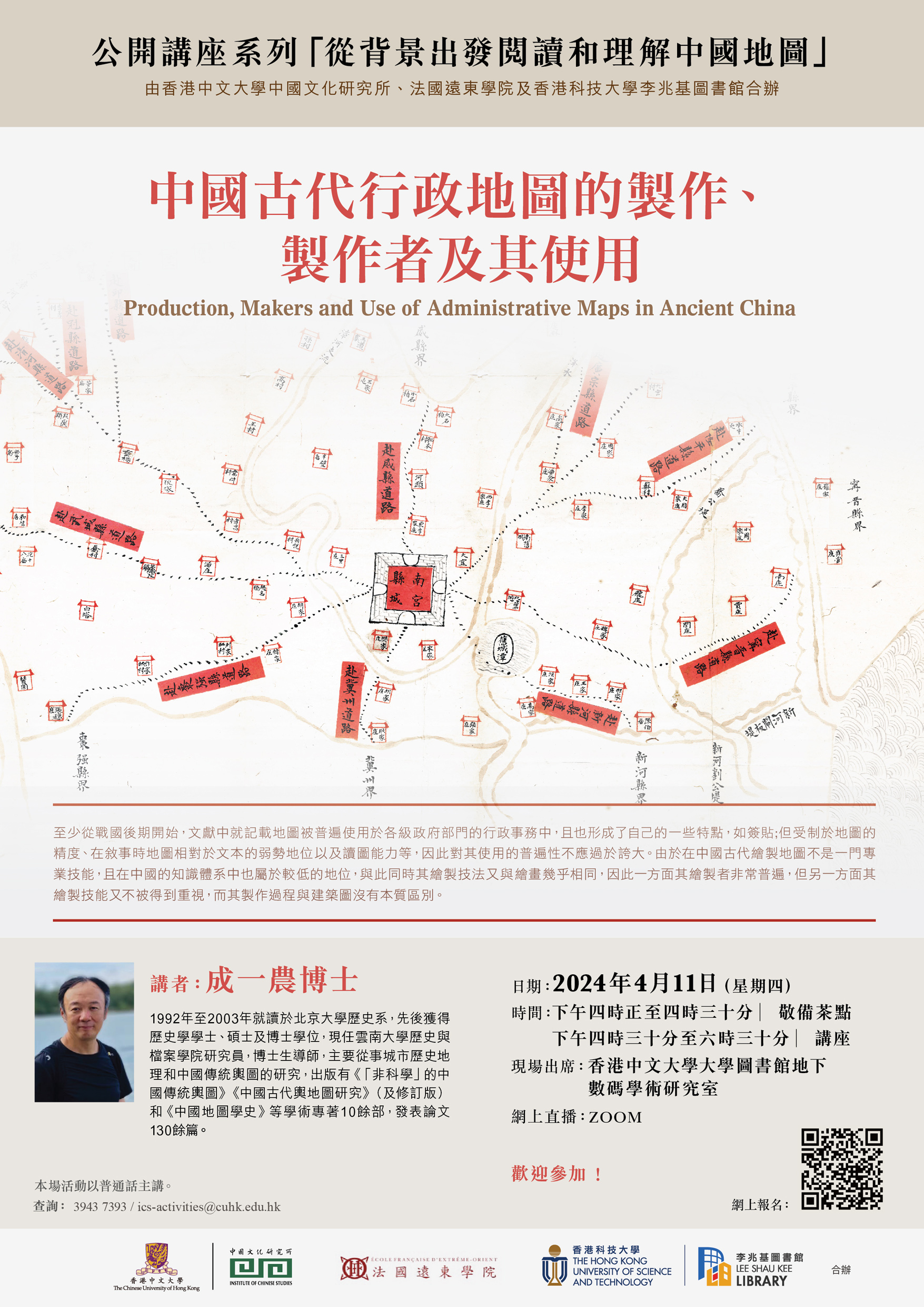
Production, Makers and Use of Administrative Maps in Ancient China Speaker: Dr. Cheng Yinong 成一農博士 Date:11 April 2024 (Thursday) Time:4:30 p.m. – 6:30 p.m. (Tea reception starts at 4 p.m.) On-site participation: Digital Scholarship Lab, G/F, University Library, CUHK Online broadcasting: ZOOM Language: Conducted in Mandarin. Online Registration: Click here |
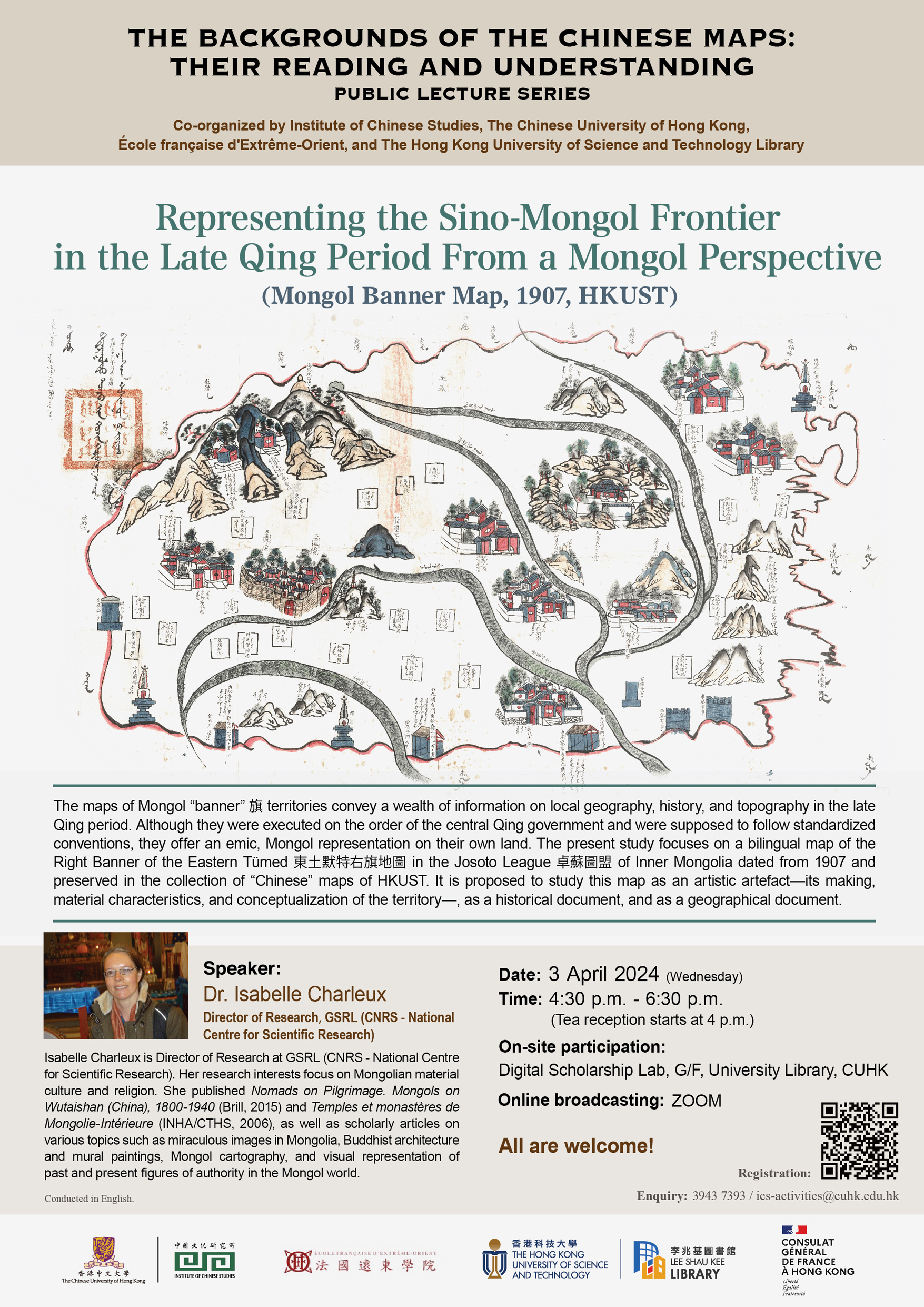 Representing the Sino-Mongol Frontier in the Late Qing Period From a Mongol Perspective (Mongol Banner Map, 1907, HKUST) Representing the Sino-Mongol Frontier in the Late Qing Period From a Mongol Perspective (Mongol Banner Map, 1907, HKUST)
Speaker: Dr. Isabelle Charleux Date:3 April 2024 (Wednesday) Time:4:30 p.m. – 6:30 p.m. (Tea reception starts at 4 p.m.) On-site participation: Digital Scholarship Lab, G/F, University Library, CUHK Online broadcasting: ZOOM Online Registration: Click here Language: Conducted in English. |
Go Back to page Top
last modified 19 March 2024