The public talks will be held in LG4, Multi-Function Room, HKUST Library, Hong Kong.
6 December 2023
|
Mapping for Money, Mapping for Influence: Western Maps of China and the Interplay between Jesuit Missionaries and Dutch Publishers (1584-1735) |
Recording |
|---|---|---|
| Abstract
Some printed maps of China were distributed in thousands of copies over many decades, others were clearly meant for a restricted audience and survive in one or two examples. I will discuss the different strategies used by mapmakers, their motivations and publishing venues and their change over time, focusing on two main entities: the Society of Jesus and Dutch mainstream printers and publishers. About the Speaker
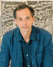
Growing up in Genova, where a short walk would bring you from the prison where Marco Polo wrote his Milione to the house of Christopher Columbus, I have cultivated a lifelong interest in travel and especially in the relationship between Europe and China. I studied History, Linguistics and Chinese at Scuola Normale Superiore in Pisa, Beijing University, and City University of Hong Kong and I received my PhD from the University of Washington, Seattle with a study of the linguistic features of Classical Chinese Bamboo Manuscripts. The past few years have been happily spent on the research and development of the library’s map collection and on the present carto-bibliography. Future plans include the continuation of the carto-bibliography into the nineteenth century and a companion volume dedicated to Chinese maps of China. |
||
6 December 2023
|
Complete Map at a Glance: The 1644 Map by Cao Junyi and Its Ideological Significance (in Putonghua) |
Recording (Sign-in Required) |
| Abstract
This talk focuses on a Chinese world map Tianxia jiubian fenye renji lucheng quantu 天下九邊分野人跡路程全圖 (Complete Map of the Allotted Fields, Human Traces, and Routes within and without the Nine Borders under Heaven), printed by a lesser-known figure Cao Junyi 曹君義 in Nanjing in 1644. I will discuss its particular representation of the world that integrates Chinese map-making traditions with the new geographical knowledge and cartographic methods of the Jesuits’ world maps. By way of a detailed comparison, I will reveal the possible Chinese source maps for Cao’s map as well as its all-inclusive form encompassing the geographical, military, political, ideological, historical, and cultural aspects. Such integrative geographical space illustrated a dynamic process in which the concept of “Unity” (Yitong 一統) was re-defined while the idea of “ten thousand states” (Wanguo 萬國) gradually took shape, making Cao’s map a vivid example of the constantly evolving trends of Chinese mapmaking in history. About the Speaker
|
||
8 December 2023
|
Re-Imagining the World: When Global and Administrative Mapping Intersected (ca. 1555-1655) |
Recording (Sign-in Required) |
| Abstract
Following direct maritime contact between the Iberian powers and the Ming Chinese empire in the sixteenth century, a series of profound encounters occurred, not between two cultural blocs but between two complex views of the world and the cosmos. As a result, a process of mutual repackaging, embedding, and borrowing took place that produced a wide range of novel artifacts, including maps, books, globes, and atlases. This talk surveys the earliest stage of artifact production, illustrating how the bridging of two intellectual universes was not just shaped by the linguistic, conceptual, and social aspects of translation processes, but also by material factors such as printing techniques, map formats, and modes of presentation. About the Speaker
|
||
8 December 2023
|
Kunyutu 坤輿圖 and Terrestrial Globes: Reproduction of World Geography in the Early 18th Century Qing Court |
Recording |
|---|---|---|
| Abstract
A large Chinese world map titled Kunyutu 坤輿圖 from the Qing dynasty was newly discovered in Switzerland in 2017. Earlier studies by the Zentralbibliothek, Zürich and other scholars incorrectly dated the map for a later period and erroneously speculated about the mapmaker. After comparing the various map elements, this map can be presumed to have been made during the late Kangxi-period, between 1707-1717. The contents of the map match the two terrestrial globes now held in the Palace Museum, and the map was revised at the end of the Kangxi-period into two other maps also named Kunyutu now held in the First Historical Archives of China. The Swiss Kunyutu and the globes probably mainly referred to Guillaume Delisle’s maps in French and other derived maps made during the first few years of the 18th century, with some placenames, graphics and most geographical text blocks referring to early world maps and geography books in Chinese by Matteo Ricci, Giulio Aleni, Ferdinand Verbiest. The Delisle’s maps, which represent the highest standard in Europe at the time, were probably introduced and translated by the French Jesuits in the Qing court, while the Chinese were also deeply involved in the cartographic process. The Kunyutu and the globes, with many confusions and errors, served mainly as decorative and display items in the Qing court, and their simplified illustrations had some influence on the public intellectual circles in the middle to late Qing Dynasty. About the Speaker
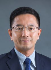
His study focuses on the history of cultural exchange between Chinese and European maps, and the historical geography of Yangtze estuary region. In recent years, he has published several papers on the maps of China by the Jesuits Michele Ruggieri, Martino Martini and Michał Boym who came to China in the late Ming dynasty, the Chinese world maps and globes of the early Qing dynasty, and the evolution of Chongming sand islands from the seventh to the twentieth century. |
||
last modified 05 March 2024


