Curious about Marco Polo’s journey in ancient China? Our interactive project in HUMA5630 (Digital Humanities) brings his vivid travel narratives to life with maps, themes, and modern research, offering a unique glimpse into China through a European lens.
Introduction
Our project centers on the journey of Marco Polo, the Venetian merchant and explorer whose travels to China in the late 13th century were chronicled in "The Travels." This historical account provides a unique European perspective on Yuan Dynasty China. Our goal was to bring Marco Polo's vivid narrative to life through an engaging, interactive website.
Designing the Website
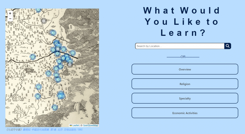
While "The Travels" mentions over 50 locations in China, the abundance of details sometimes lacks a coherent flow. To address this, we created an interactive map that pinpoints all the locations mentioned and provides key insights for users.
We highlighted the themes of religion, specialties, and economic activities described in various locations. Our website organizes information on these themes and categorizes specialties by genre for easy navigation. Users can see the distribution of these themes on the map by clicking corresponding buttons.

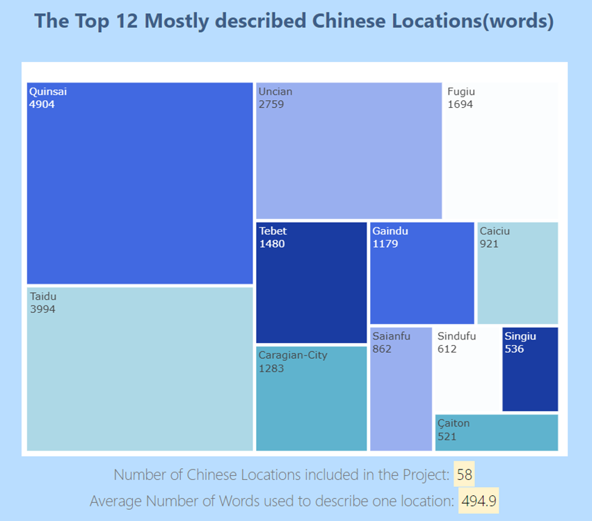
We also recognized that some locations are briefly mentioned while others are described in detail. This uneven distribution highlights certain places more vividly, revealing the foreign traveler's unique perspective. To illustrate this, we featured the 12 most described locations on the map under the "Overview" button. Users can explore these locations in depth, with summaries from Marco Polo's accounts alongside insights from modern researchers. This comparison helps users understand key research questions before delving further into the book and conducting their own research.

Preparing the Interactive Map
The interactive map is the key feature of our website. With help from our teachers, we located a Song Dynasty map that closely aligns with Marco Polo's time in China. This historical map serves as the base to display his travel routes, allowing users to visualize the geographical context of his journey and understand the challenges and opportunities he encountered.
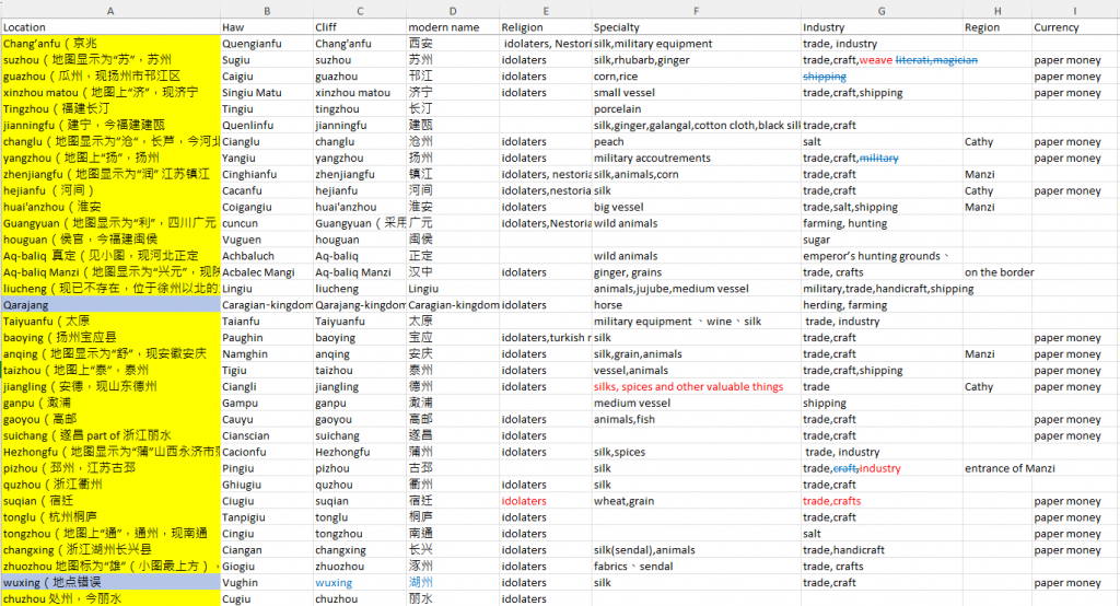
However, using a historical map presented challenges. The place names on the historical map often did not correspond with those used by Marco Polo. For example, Hangzhou is shown on the map, but Marco Polo called it Xingzai. To overcome this, we conducted extensive research using literature appendices and online sources.

Even after identifying the modern names of the cities mentioned by Marco Polo, marking them individually on an ancient map was difficult. Initially, we considered overlaying a modern map onto the ancient one, but the inaccuracies in Song Dynasty maps made this impractical. Instead, we manually compared ancient and modern maps to ensure precise and reliable placement of cities. For locations not recorded on historical maps, we estimated their geographic locations by comparing them with modern maps, ensuring accuracy and reliability in our website's information.
By combining historical maps, detailed descriptions, and modern research, we offer users a comprehensive understanding of Marco Polo's travels and perspectives. This website serves as a valuable resource for anyone interested in exploring ancient China through the eyes of one of its most famous foreign visitors.


